Tag: Camping (Page 1 of 2)

Grand Illinois Trail (GIT) – Part 2

This post is a continuation of my Grand Illinois Trail experience, which I started in Part 1, here.

Day 4 (9/12/17) Gebhard Woods to Matteson, Illinois (~50 miles)

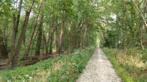
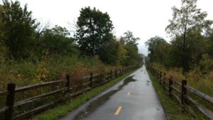
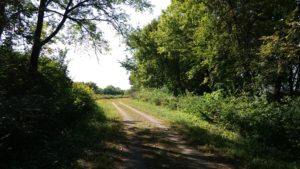
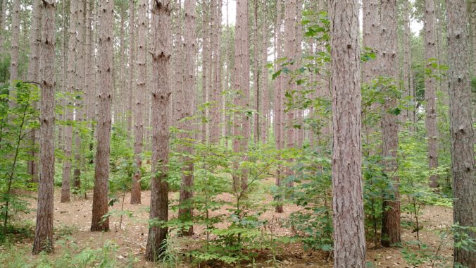
We woke up at Gebhard Woods, packed up our gear, and resumed riding the I&M trail. Prior to the trip, I hadn’t been sure about what to expect in terms of how well-maintained it would be. I was pleasantly surprised, however, that it turned out to be a very nice trail. The weather was hot and could have become uncomfortable, but the trail had tree cover for most of the way.

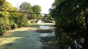
The surface was a mix of crushed limestone and pavement, making for smooth riding. As with many canal towpaths I’ve been on (which yes, is only like 3), the actual canal was green and boggy from being out of use. One wonders what creatures lurk beneath the surface. That reminds me, thus far on the trip, I had accidentally eaten approximately five bugs and had seen one snake.

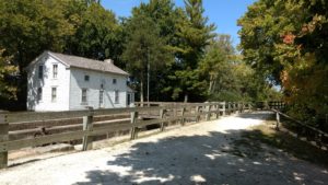
We also passed several locks and old lockhouses. It would be cool if someone would turn the old lockhouses into lodging for bikers and campers. Or, maybe a little diner?

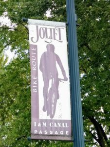
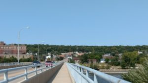
Eventually, we got off the I&M trail at Joliet, where we then rode about 6 miles through the city. Along the way, we noticed some signs indicating Joliet takes pride in the I&M trail:

In Joliet, we made our way to the Old Plank Road Trail, which is neither old, nor a road, nor made out of planks. It’s actually probably the nicest section of the Grand Illinois Trail that I experienced, as it’s a converted rail-trail that is completely paved and tree-lined!

We rode the Old Plank Trail into Matteson, Illinois, suddenly feeling quite close to Chicago. After all, we had traversed past Interstate Highways 55 and 57 today, often hearing the buzzing of cars and semis in our trek north and east toward the city.

For sleeping, instead of camping, we opted for a hotel. Sometimes it’s nice to have a warm shower and beds! Also, one of the bolts on my bike rack had broken on the ride today. With some bike tools and zip ties, we were able to repair it enough on the trail and at the hotel to make the journey home!

Day 5 (9/13/17) – Matteson to Chicago (~60 miles)

We woke up and had breakfast at the hotel. Today, Ellen’s friend Tom would be joining us for the final leg of the trip! We began our ride on the Old Plank Trail in some light rain. Today, we quickly learned, would be a mix of cityscape and nature as we entered the Chicago area.

We were only on the Old Plank Trail for a couple of miles before we turned onto the Thorn Creek Trail, which is also a very nice, paved 17-mile trail in the Forest Preserve system (also a converted rail-trail). From there, we traveled to the Burnham Greenway, which was not my favorite part of the trip because I got two flat tires on it. The trail crosses some busy streets and I ran over some glass. Don’t litter!

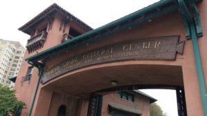
And then, just like that, we were on the south side of Chicago. We stopped for a quick break at the South Shore Cultural Center and then hopped on the famous Lakeshore Trail, which would take us north.

I thought the Lakeshore Trail might be crowded, as it often is, but it wasn’t too bad. It was about 3:30 pm on a weekday, and it was chilly, so maybe those factors had something to do with it. Regardless, riding north on the Lakeshore Path is a great way to enter Chicago!

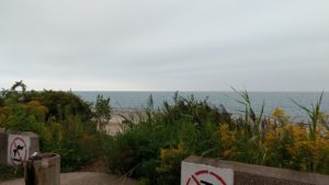
After more than 200 miles of riding through Illinois terrain, here was my first view of Lake Michigan, on the south side of the city:

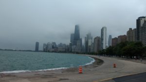
And then, here’s a shot once I arrived on the north side of the trail, looking south toward downtown:

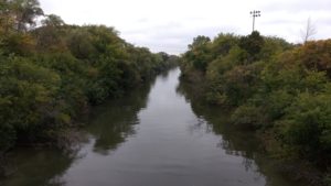
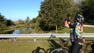
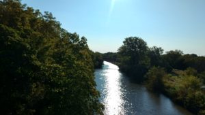
At the Lawrence exit, I got off the trail and headed west toward the North Shore Channel Trail. I live north of the city, and while this trail is not technically part of the Grand Illinois Trail, it was my way home! It’s a nice trail, as well, although short at only about 6 miles long. Here is a shot from that trail, overlooking the Chicago River.

And then, I arrived home at last and promptly ordered take-out!

Final mileage: 241.

Final Thoughts: Overall, I felt well-prepared for this trip. I work out almost every day already, and have been biking at least once per week for the past several years. In the two months leading up to this trip, I upped my biking, primarily on an indoor trainer, to twice per week. My training rides consist of one shorter ride during the week of about 40 minutes and then one longer ride on a weekend day of at least an hour.

From a gear standpoint, given that I had three flat tires on this trip, I will definitely bring multiple C02 cartridges on the next trip. I didn’t bring any, mostly because I had grown complacent about flat tires after having not experienced one on a bike trip before.

Finally, I’m grateful that I got to experience this trip and that Ellen invited me along to join her adventures. The past year I’ve experience some major life changes for me, both positive and difficult, including the birth of a child and the death of a parent, and it was just really nice to be out in the country only having to worry about biking to our next destination day after day.

Here’s to many more miles to ride, I hope!
Grand Illinois Trail (GIT) – Part I

Last week, I had the fun experience of joining my friend Ellen on a bike-camping trip along the Grand Illinois Trail (GIT).  In short, the GIT is a network of bike trails and roads that traverse the northern part of Illinois, in a loop of approximately 575 miles.

Ellen rode the whole thing (impressive!) and I joined her for the final 5 days of riding, from (roughly) the Quad Cities to Chicago.  As with previous bike-camping trips, the plan was to pack all of our gear onto our bikes, using racks and panniers, and then primarily camp along the trails.

Here is the journal I kept of my GIT experience, with photos:

Day 1 (9/9/17) – Hennepin Canal Lock 26 to Hennepin Canal Lock 21 (+ some city riding):  51 miles

To begin this journey, I had a 5 am wake-up call in Chicago to ride about 12 miles to Union Station. My plan was to take the Amtrak to Kewanee, Illinois and then meet Ellen along the Hennepin Canal Parkway, the 105-mile trail that goes across Illinois from the western border at the Quad Cities to its mid-point near Bureau Junction, Illinois.

But first, my ride into Union Station was smooth sailing. It was a Saturday before the sun was up, so I rode on city roads with very little traffic. I took this picture just south of Lincoln Park:

I boarded the Amtrak shortly after arriving at Union Station and had a very nice 2.5 hour train ride to Kewanee.  Suddenly, I was no longer in the big city. I had arrived at a nearly-empty train station. It’s okay though, I’m from a small town. Sometimes, it’s nice to get away!

From Kewanee, my sister, who lives nearby, picked me (and my bike/gear) up and dropped me off at the Hennepin Canal, at Lock 26 near Geneseo, Illinois, where I had planned to meet Ellen. The Lock and trail were both pretty easy to find and at a first glance, the trail seemed to be in decent shape, with a mix of packed gravel and asphalt. Although, I should mention that we decided upon this meeting point because the parts of the trail to the west were not in usable condition, due to storms and state budget issues (apparently).

Ellen arrived at the meeting point shortly thereafter and, together, we rode our bikes about 39 more miles to Lock 21 on the Hennepin Canal. The Hennepin Canal trail is an old towpath along a canal that was completed in the early 1900s. Unfortunately, by the time it was finished, this mode of transporting goods was obsolete, and so it was never really used for its intended purpose.  On the upside, it’s now getting use as a recreational trail.

At one point, the Hennepin trail splits and veers north in one direction and east in another. We accidentally rode on the north branch for about a half mile, but quickly realized our mistake and got back on track!

Then, as luck would have it, I got a flat tire just as we rolled into our campsite. I suppose there are worse times and places to get a flat! Anyway, it was getting dark by the time we arrived at the campsite, so we set up our tents in a hurry and camped right near Lock 21, in a nicely-maintained clearing. The tire would be dealt with in the morning.

Weatherwise, it was a very pleasant September day, sunny and in the 70s.

Day 2 (9/10/17) – Hennepin Canal Lock 21 to Starved Rock State Park: ~50 miles

I slept well in my tent, as I usually do on bike trips due to exhaustion, and woke up at around 7 am. I set about fixing my flat (the first one I’ve had on a bike trip!). Note to self: C02 cartridges make fixing flats much more efficient than my little hand pump. Anyway, my bike repaired and breakfast eaten, we packed up our gear and resumed the ride.

Spoiler alert: Ellen likes to take a lot of pictures along the way, which is nice because it forces me to stop speeding along, enjoy the scenery, and take pictures for this website and my memories:

The first part of our day, it was smooth sailing on the Hennepin Canal trail for about 20 miles to the trailhead in Bureau Junction.

At Bureau Junction, we decided we wanted lunch at a diner, so we could eat more of a real meal than our camp food. We came across this little roadhouse/motel called Jonesie’s Ranch, which served American and Philipino fare and also was a motorcycle bar. There, the friendly waitress served us egg sandwiches stacked with approximately 4 fried eggs each and a vodka cocktail because why not.

From there, we rode about 25 miles on country roads. We had initially started the day cruising along, thinking the day would be pretty easy, but once we got to the roads, we encountered some highway riding where it seemed unsafe to ride around some of the curves. So, we ended up walking our bikes up and down some of the hills.

Near the end of the day’s ride, we reached the western trailhead of the Illinois & Michigan (I&M) Canal State Trail, an ~77 mile trail that is also an old towpath. Near the trailhead, there is an old-timey boat like the kind that used traverse the canal, along with information about the canal’s history. The canal’s purpose was to connect Lake Michigan to the Mississippi River.

We eventually made it to our campsite at Starved Rock at around 7:30 pm. There, we were able to take warm showers and cook a meal, but it was too late to do any hiking or sightseeing at Starved Rock. The campsite was nice, clean, and secluded.

Day 3 (9/11/17) – Starved Rock State Park to Gebhard Woods: ~35 miles

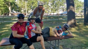
In the original itinerary, today was going to be a rest day to relax and do some fun stuff at Starved Rock State Park. However, that would have meant the following day would be about an 80 mile day. We decided to do a shorter ride today, rather than do that long ride. Here we are packing up our bikes. We were each carrying about 60 pounds of gear. Did we pack too much, as usual? Probably. But, it’s important to have Oreos, face masks, and flasks of liquor.

We started by taking things slow on country roads out of Starved Rock. Again, although it got a little chilly at night, it was a beautiful, sunny September day and I was reminded how much I enjoy seeing the country on bicycle.

We rode on country roads maybe 20 miles or so, because the I&M trail was washed out and unusable for this portion of the ride.  At Marseilles, Illinois, we were able to hop back on the I&M trail and it was smooth sailing the rest of the way!

We encountered a high school cross country team, which was doing a practice run on the trail. The kids were friendly, but didn’t look very happy doing all that running. I can’t blame them.

Anyway, as with most of the trip thus far, we also saw a lot of yellow, orange, and green colors in the scenery and vegetation.

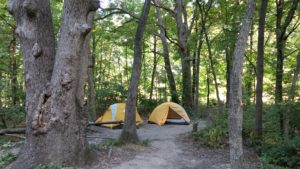
Somewhere along the way, we decided to make our destination Gebhard Woods in Morris, Illinois. We arrived there at around 5:30 pm or so and set up camp. Only one other camper was there, so we really had the place mostly to ourselves. Also, for the first time on the trip, we gathered firewood and made a fire!
Want to see how the trip ends? Continue on to Grand Illinois Trail, Part 2!
White Pine Trail – Part II

This post is a continuation of the 2016 White Pine Trail bike trip, which I did with 4 other people.

Day 3: July 4 – Cadillac to Morley  (~60 miles)

Some people don’t like doing out and back rides, but I don’t mind them.  I feel like reversing our trip the next day and riding from Cadillac to Morley allowed me to see things I didn’t see the first time around.  Plus, if you go uphill one day, it’s nice to go downhill the next.

Ready for day 3

Ready for day 3

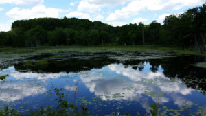
Cadillac south to Tustin is a beautiful ride, with a lot of nature and a lot of downhill riding.  Along the way, we stopped at a boggy area and saw snakes, turtles and frogs making various reptile noises.

27540309513_38684411b0_k

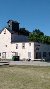
Once in Tustin, which seems to be a quite small town, we saw an old lumber and grain building.

IMG_20160704_101331135

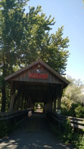
We then passed through Reed City again, including a covered bridge.  While there we also ate at a great jeep-themed diner called 7 Slots.

IMG_20160704_121707271

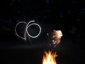
Eventually, we made it back to Morley and Mecosta Pines, where we were spending another night.  We had great weather and it was overall a good day of riding.  Since it was July 4th, we also had to indulge in some sparkler action – although it turns out fireworks and sparklers are not allowed at Mecosta Pines (ooops!).

Rule-breaking

Rule-breaking

Day 4: July 5 – Morley – Grand Rapids (~35 miles)

We ended with a relatively swift day of riding. We rose early and managed to pack up camp and be on our bikes by about 8:15 am.  Impressive!  I think all of our butts were quite sore at this point, as can be expected.

While some trails might be more majestic (the rolling terrain of GAPCO) or impressive (the famous tunnels of Elroy-Sparta), what I appreciated about the White Pine Trail was that it seemed well-maintained and had a classic Midwestern feel to it – with farmland.

IMG_20160704_152345174

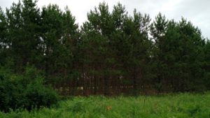
Beautiful nature:

IMG_20160704_154454360

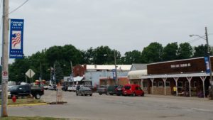
And small towns:

Sand Lake, Michigan (2016)

Sand Lake, Michigan (2016)

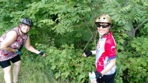
(Oh, and did I mention berries?)

Stopping for a snack of raspberries!

Stopping for a snack of raspberries!

Once we reached Grand Rapids, we packed up our bikes and headed to a diner for lunch before heading home.  It was a great trip and we lucked out with having good weather – no rain and not too hot.

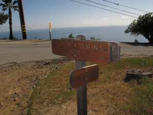
Trans Catalina Trail, Part 2

Have you read Wild, by Cheryl Strayed – or seen the movie?

Well, when I read the book, I remember feeling pretty judgmental of her twice. One, for taking off on a backpacking trip that she seemed so unprepared for: “What is hiking, but walking after all? I can walk!”  And two, for packing a ridiculously-heavy pack.

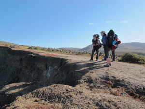
Well…. so, living in the Midwest, one detail we might have overlooked on the TCT was elevation change.  The TCT is, to put it bluntly, brutal in terms of elevation changes. For most of it, you are either hiking up or hiking down – steeply. And despite its steepness in many places it does not include many switchbacks that would help make the hike less strenuous. For comparison, I have hiked up and down the Grand Canyon, and even that did not seem as steep as some of the inclines on the TCT.

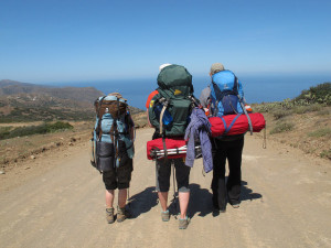
After leaving the restaurant in Avalon, I remember settling my pack onto my back, with a little help from my friends, and thinking, “… really?” Then, like Strayed (who was hiking the Pacific Crest Trail), I remember being about 30 minutes into the hike and thinking, “What have I gotten myself into?”, among less polite… things.

My backpack, estimated at about 35 pounds, was digging into my shoulders. When I adjusted the straps on my shoulders to put more weight on hips, my hips fatigued very quickly. My water bottles were annoyingly clanking around behind me. I questioned my shoe choice (trail running shoes rather than hiking boots). I could not get comfortable and just ease into the simple act of walking, uphill.  I had, stupidly, over-packed.

And then, we eventually arrived at the trailhead, Mile 0 of the TCT:

Mile 0

Welp, time to get started!

At this point, we decided it would be a good time to stop and stretch for a bit. It was also here that I realized that the group was about on the same page in terms of the hike being difficult, and that it wasn’t just me who was feeling challenged. The uphill hike had begun almost immediately after leaving the restaurant, before we even reached the trail. So, that was something – I at least wouldn’t have to worry about others wanting to go super fast and me slowing everyone down.

It was also a good break for me, mentally, to remember that the first couple days of every backpacking trip I’ve been on have been very difficult. There’s a “breaking in” period where different muscles are used, become sore, and then get a little more used to the act of backpacking.

16370041733_f8c14522db_z

Here we go

And so, onward we went. The first day, from Avalon to Hermit Gulch Campground, I remember feeling as though the vistas were incredible – we were surrounded by the Pacific Ocean, and kept seeking Avalon at different angles, from above, getting smaller and smaller.  We took the first day pretty slow, averaging maybe 2 miles per hour, climbed to a high of about 1,800 feet and descended again just about all the way to sea level to our campground. That first night, I crashed hard, falling asleep at 8 pm, before everyone else, and practically didn’t open my eyes again until 7 am.

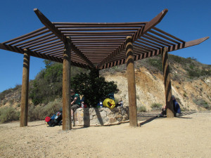
Day 2 began with, what else, a very tough 1.2 mile climb out of Hermit Gulch campground of about 1,500 feet. At the top, was this convenient little pavilion thingy, where we of course took a break:

Pavilion

Relief!

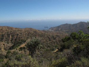
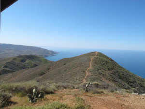
This day was also quite difficult, but again, we were surrounded with stunning views in terrain very different from the Midwest:

16989540321_6973d3a575_z (1)

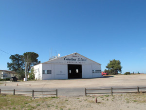
Blackjack Campground was primitive, but still very clean, like all of the campsites we saw on Catalina. Lauren and I took ice cold open air showers, and the 12 or so other people at the campground mostly did their own thing. The next day, Day 3, was the day I felt the best hiking. My soreness from the previous 2 days was largely gone, the weather was cool, and we got to see Airport in the Sky:

16989008352_35dddca182_z

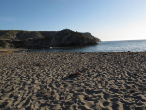
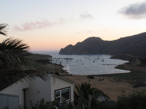
The Airport had an old-timey diner in it, so we got to eat some good cooked food for lunch, and also use real restrooms – true luxuries while backpacking! The last half of the day was mostly downhill, which is painful in a whole different way compared to uphill, and we arrived at my favorite campsite of the trip, at Little Harbor. There, we had a prime campsite right on the beach.

Little Harbor

Little Harbor

After swimming (with a harbor seal spotted!), frisbee playing, and karate practice in the sand, we had dinner and played cards.  Foxes were quite common near campgrounds on the island, especially as the sun set. They were friendly to people, looked pretty cute, and mostly were very interested in trying to get our food. To keep our food safe, we kept some of it stored in a bear can overnight and hung the rest of it in the palm trees in bags, both of which worked well.

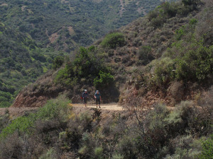
The next day, Day 4, was going to be our longest, most difficult day, from Little Harbor to Parson’s Landing. We began the day with a very difficult 2 miles hike up about 1,500 feet and then down the same distance and elevation into Two Harbors. The temperature this day was in the mid-80s, making the hike particularly grueling. The footing at times was also loose rock and felt precarious, but the scenery was also beautiful:

16988814032_934841dbcd_z

After a lunch break in Two Harbors, we opted to take the West End Road to Parson’s Landing, which was a longer yet flatter path to Parson’s Landing.

West End Road

However, we eventually decided to go back to Two Harbors. A couple of us weren’t feeling well, I had a mystery rash spreading up my legs, we had seen much of the island already, and we felt that we had accomplished a lot. What I have learned on various adventure trips is the importance of adjusting itineraries in response to the physical environment and changing circumstances. We learned this repeatedly on the Great Allegheny Passage/C&O Towpath (GAPCO) bike trip!

Hiking the Trans Catalina Trail was, for me, amazing and also very difficult.

...Really?

It was nice to give in, spend an extra day in Two Harbors, and have a more relaxing vacation before having to return to our daily lives and work back in the Midwest.

One of the Two Harbors

One of the Two Harbors

For anyone planning to hike this trail, I’d recommend lots of incline training. I also think we went at a good time of year (late March), but got a little unlucky with the heat on 1 day. The trail didn’t seem super crowded, and we encountered enough other people so that it didn’t feel completely isolated. The people we did encounter were generally friendly. All in all, it was a great trip.

(See also, Trans Catalina Trail Part 1)

« Older posts