In July 2013, I was part of a small group that biked Katy Trail State Park (aka – the Katy Trail).
This trail runs 237 miles across the state of Missouri, along what was formerly the MKT trail line. Now, I didn’t have this website back in 2013, but I’m going to try to piece together the trip as best I remember from my notes and itinerary.
On this trip, I went with 3 other people. Like GAPCO, we did this trip entirely self-supported, carrying our own gear on panniers. Unlike GAPCO, where we camped and stayed in hotels half the nights, we stayed in hotels/B&Bs every night of this trip. That definitely made the trip more comfortable, as it’s nice to have a soft bed at the end of riding all day. However, after doing both, I prefer to add in camping, both because I really enjoy camping and because it makes the trip less expensive. What I’ve found is that bike adventure trips can be as inexpensive (or not) as you make them, and staying in hotels and eating at restaurants each night definitely adds up on a trip.
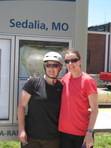
Logistically, the trip began with our group driving in a small SUV, with a bike rack carrying 4 bikes, to St. Louis, MO. From St. Louis, we took an Amtrak to Sedalia, MO, near the Western terminus of the trail. Technically, the trail starts a bit further west in Clinton, MO, but the Amtrak doesn’t go to there.
Day 1- Sedalia to Boonville (35 miles)
Once we arrived in Sedalia, we had a nice lunch at a diner, finalized preparations on our bikes, and then took off. What I remember is that we kept our first day of biking pretty light, only going from Sedalia to Boonville – about 35 miles. Still, it was very hot and humid, and we were adjusting to carrying gear on our bikes! We were all glad it was a “short” day.
At Boonville, we stayed at the Isle of Capri Casino, where we had made reservations prior to the trip. I was quite glad of having a room and a bed. Plus, casinos tend to have great air conditioning. Playing roulette and having a few cocktails also helped us recover from the day of traveling and riding.
Day 2- Boonville to Hartsburg (~40 miles)
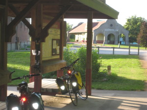
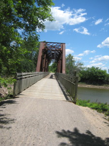
From Boonville, our next destination was the Katyrest Caboose in Hartsburg. I remember enjoying this section of the trail, as it followed pretty closely to the Missouri River and was rather shaded by tree canopies. This part of the country is really quite lovely:
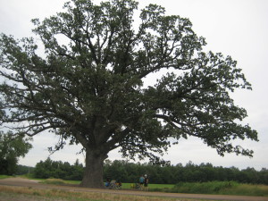
Excitingly, we went a tad off the trail to stop by and see the World’s Largest Oak Tree. It seemed true to its name:
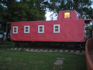
And then, most excitingly of all, we arrived at the Katyrest Caboose, where we got to relax and cool down from the day’s ride:
Day 3 – Hartsburg to Marthasville (76 miles) –
Dun dun dun! Day 3 was our longest of the trip, clocking in at 76 miles. Which, on a light road bike and without panniers, is not all that difficult. But, with packs, on crushed limestone, and hybrid/mountain bikes, is a little more difficult. Not that I’d trade it for a vacation of lounging on a beach and doing nothing, of course!
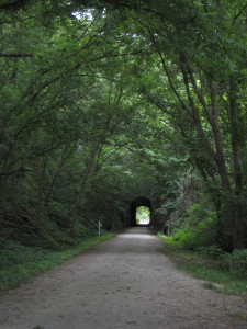
The Midwest has a reputation of being “flyover country,” but I continued to be impressed by the landscape on this ride. We went over many bridges, through tunnels, along bluffs, and through stretches of forest that I’m sure many people never see.
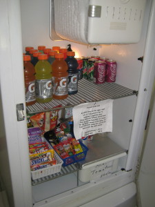
Also, like GAPCO, the Katy Trail has cool, quirky features to show hospitality to those who ride. Along the way to Marthasville, there was a non-staffed rest stop with a stocked refrigerator operating on the honor system. I’m not sure who fills the ‘fridge with Gatorade, sodas, and snacks, but we were grateful for it (and we dropped money into the canister):
On this day, I also remember getting a mystery rash on my legs during the last couple hours. Exciting! It turns out I get heat rash on my lower legs, probably due to combination of dust, sun, and sweat. I also experienced this on the Trans Catalina Trail. (Was that too much information?).
Day 4 – Marthasville to St. Charles (~38 miles) –
On our next to last day of riding, we rode from Marthasburg to just outside of St. Louis, in St .Charles. As we got closer to the city, the trail got more and more crowded with other bikers and families. While before, in more rural locations, we were able to ride 2×2, we were most relegated to riding single file.
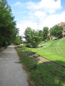
Just as we were arriving in St. Charles, where he had a hotel room reserved, it began to rain. Luckily, that was really the only time we got rained on during the trip. In St. Charles, the trail ran parallel to an abandoned (I think?) rail line.
Day 5 – St. Charles to St. Louis (~40 miles) –
The last day of a bike trip is always bittersweet for me. On the one hand, it’s always such an accomplishment to finish a trail, but that also means the vacation is over. Nonetheless, we departed from St. Charles and headed for St. Louis, to the Amtrak station where the car had been parked.
Probably for all of us, this was the most harrowing riding of the trip. We had been accustomed to riding on trails segregated from cars, but once we got into St. Louis and headed toward the Amtrak station, the trail ended, putting us on roads without bike trails. If I were to do this ride again, I would pay more attention to the ride from St. Charles to St. Louis and try to find a less congested route.
In all, it was a great trip, and I really would consider riding the Katy Trail again, perhaps adding some camping nights into the experience!
Recent Comments