Have you read Wild, by Cheryl Strayed – or seen the movie?
Well, when I read the book, I remember feeling pretty judgmental of her twice. One, for taking off on a backpacking trip that she seemed so unprepared for: “What is hiking, but walking after all? I can walk!” And two, for packing a ridiculously-heavy pack.
Well…. so, living in the Midwest, one detail we might have overlooked on the TCT was elevation change. The TCT is, to put it bluntly, brutal in terms of elevation changes. For most of it, you are either hiking up or hiking down – steeply. And despite its steepness in many places it does not include many switchbacks that would help make the hike less strenuous. For comparison, I have hiked up and down the Grand Canyon, and even that did not seem as steep as some of the inclines on the TCT.
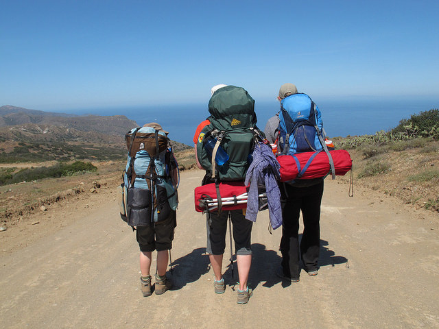
After leaving the restaurant in Avalon, I remember settling my pack onto my back, with a little help from my friends, and thinking, “… really?” Then, like Strayed (who was hiking the Pacific Crest Trail), I remember being about 30 minutes into the hike and thinking, “What have I gotten myself into?”, among less polite… things.
My backpack, estimated at about 35 pounds, was digging into my shoulders. When I adjusted the straps on my shoulders to put more weight on hips, my hips fatigued very quickly. My water bottles were annoyingly clanking around behind me. I questioned my shoe choice (trail running shoes rather than hiking boots). I could not get comfortable and just ease into the simple act of walking, uphill. I had, stupidly, over-packed.
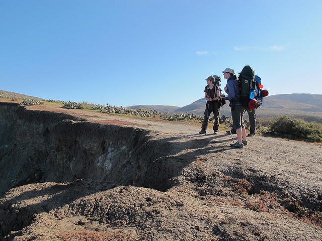
And then, we eventually arrived at the trailhead, Mile 0 of the TCT:

Welp, time to get started!
At this point, we decided it would be a good time to stop and stretch for a bit. It was also here that I realized that the group was about on the same page in terms of the hike being difficult, and that it wasn’t just me who was feeling challenged. The uphill hike had begun almost immediately after leaving the restaurant, before we even reached the trail. So, that was something – I at least wouldn’t have to worry about others wanting to go super fast and me slowing everyone down.
It was also a good break for me, mentally, to remember that the first couple days of every backpacking trip I’ve been on have been very difficult. There’s a “breaking in” period where different muscles are used, become sore, and then get a little more used to the act of backpacking.
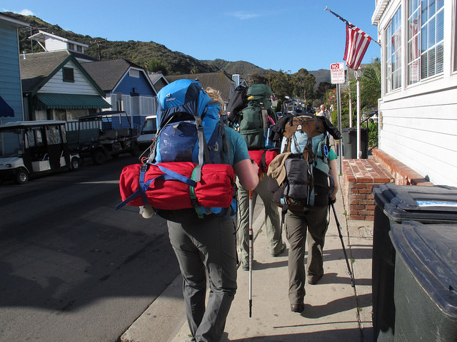
Here we go
And so, onward we went. The first day, from Avalon to Hermit Gulch Campground, I remember feeling as though the vistas were incredible – we were surrounded by the Pacific Ocean, and kept seeking Avalon at different angles, from above, getting smaller and smaller. We took the first day pretty slow, averaging maybe 2 miles per hour, climbed to a high of about 1,800 feet and descended again just about all the way to sea level to our campground. That first night, I crashed hard, falling asleep at 8 pm, before everyone else, and practically didn’t open my eyes again until 7 am.
Day 2 began with, what else, a very tough 1.2 mile climb out of Hermit Gulch campground of about 1,500 feet. At the top, was this convenient little pavilion thingy, where we of course took a break:
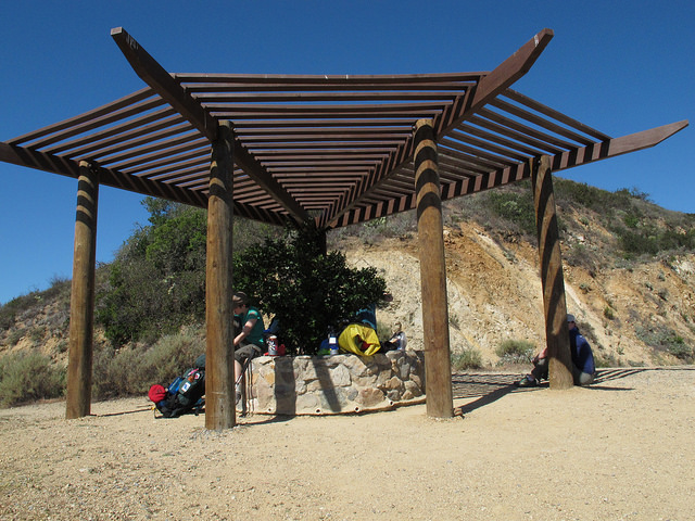
Relief!
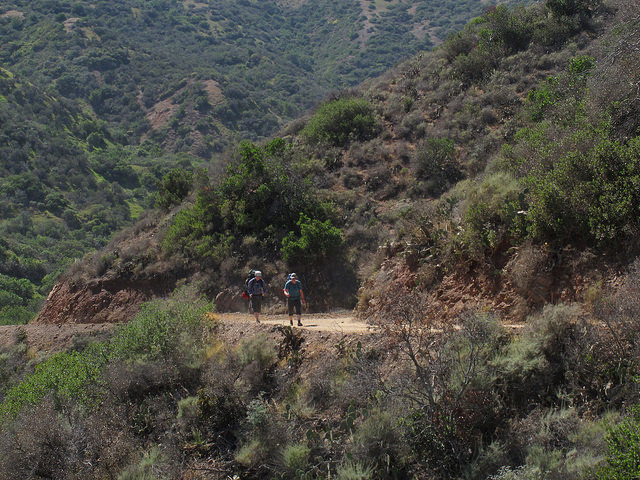
This day was also quite difficult, but again, we were surrounded with stunning views in terrain very different from the Midwest:
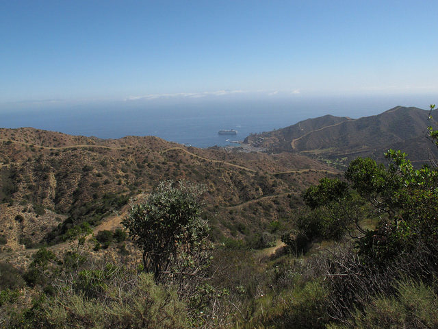
Blackjack Campground was primitive, but still very clean, like all of the campsites we saw on Catalina. Lauren and I took ice cold open air showers, and the 12 or so other people at the campground mostly did their own thing. The next day, Day 3, was the day I felt the best hiking. My soreness from the previous 2 days was largely gone, the weather was cool, and we got to see Airport in the Sky:
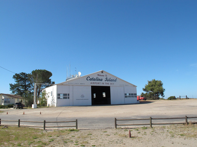
The Airport had an old-timey diner in it, so we got to eat some good cooked food for lunch, and also use real restrooms – true luxuries while backpacking! The last half of the day was mostly downhill, which is painful in a whole different way compared to uphill, and we arrived at my favorite campsite of the trip, at Little Harbor. There, we had a prime campsite right on the beach.
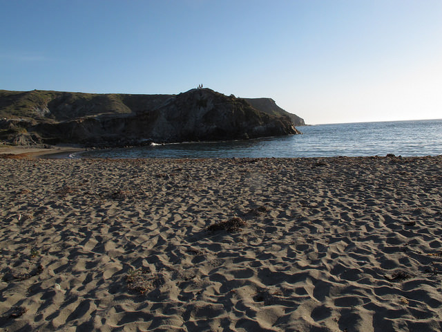
Little Harbor
After swimming (with a harbor seal spotted!), frisbee playing, and karate practice in the sand, we had dinner and played cards. Foxes were quite common near campgrounds on the island, especially as the sun set. They were friendly to people, looked pretty cute, and mostly were very interested in trying to get our food. To keep our food safe, we kept some of it stored in a bear can overnight and hung the rest of it in the palm trees in bags, both of which worked well.
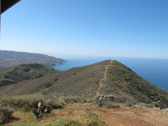
The next day, Day 4, was going to be our longest, most difficult day, from Little Harbor to Parson’s Landing. We began the day with a very difficult 2 miles hike up about 1,500 feet and then down the same distance and elevation into Two Harbors. The temperature this day was in the mid-80s, making the hike particularly grueling. The footing at times was also loose rock and felt precarious, but the scenery was also beautiful:
After a lunch break in Two Harbors, we opted to take the West End Road to Parson’s Landing, which was a longer yet flatter path to Parson’s Landing.
However, we eventually decided to go back to Two Harbors. A couple of us weren’t feeling well, I had a mystery rash spreading up my legs, we had seen much of the island already, and we felt that we had accomplished a lot. What I have learned on various adventure trips is the importance of adjusting itineraries in response to the physical environment and changing circumstances. We learned this repeatedly on the Great Allegheny Passage/C&O Towpath (GAPCO) bike trip!
Hiking the Trans Catalina Trail was, for me, amazing and also very difficult.
It was nice to give in, spend an extra day in Two Harbors, and have a more relaxing vacation before having to return to our daily lives and work back in the Midwest.

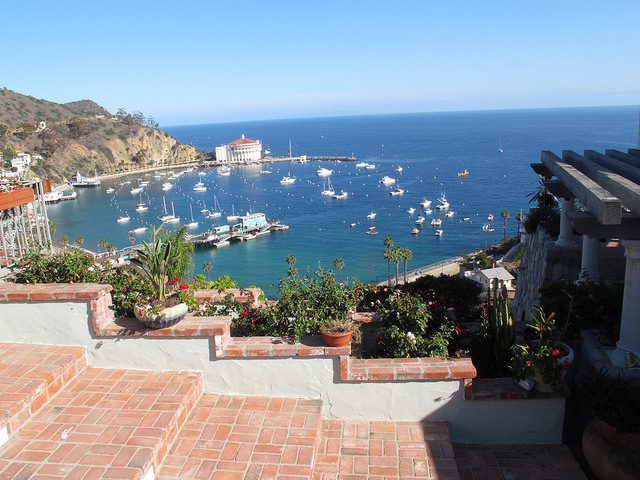
One of the Two Harbors
For anyone planning to hike this trail, I’d recommend lots of incline training. I also think we went at a good time of year (late March), but got a little unlucky with the heat on 1 day. The trail didn’t seem super crowded, and we encountered enough other people so that it didn’t feel completely isolated. The people we did encounter were generally friendly. All in all, it was a great trip.
(See also, Trans Catalina Trail Part 1)
Recent Comments