Page 2 of 6

Elroy-Sparta and La Crosse River State Trails

This past weekend, I joined 4 others on an informal trip to Wisconsin’s Elroy- Sparta Trail and La Crosse River State Trail.  The Elroy-Sparta has the distinction of being America’s first rails to trails project, established in 1965, making this year its 50th anniversary!

The trail itself is about 32 miles long, and connects with several other trails, including the La Crosse, in an interrupted chain of about 100 miles.  We didn’t have time to plan for or do a full out and back of the entire chain of trails, so our itinerary for the weekend, just finalized a couple weeks prior, was as follows:

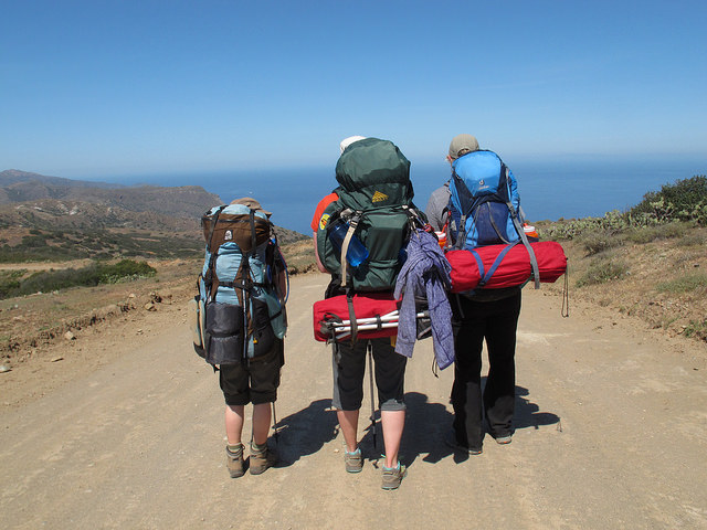
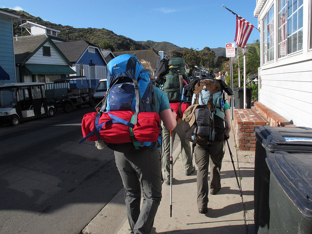
  • Day 1: Arrive at Elroy Commons, park our cars, and bike 32 miles to Sparta.  For lodging, we planned on “bike-packing,” that is, carrying all of our camping gear in panniers and staying at the Department of Natural Resources (DNR) campground in Sparta;
  • Day 2: Depart from Sparta on bike, ride part of the La Crosse River State Trail for an out and back trip,  returning to the Sparta DNR campground for the evening (round trip total ~ 30 miles); and
  • Day 3: Depart from Sparta and bike back to Elroy Commons to our cars – 32 miles.

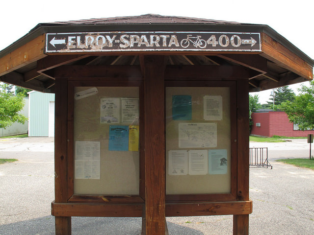
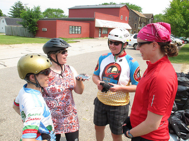
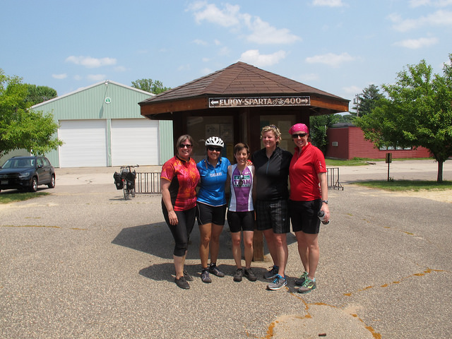
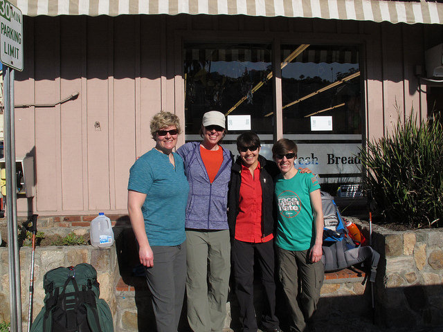
In addition to myself, those on the trip included Lauren, Ellen, Autumn, and Yesica (with Yesica taking all of the great pics posted here!).  On July 3, we met early in the morning, packed up the cars, and made the drive to Elroy, Wisconsin.  Upon reaching Elroy, we easily found the Elroy Commons, which is the start/finish of both the Elroy-Sparta Trail and the 400 State Trail. There, we were able to buy trail passes for the entire weekend, which are required for riding the trail:

Elroy Commons

After eating breakfast (for lunch) at a diner in Elroy, we were eager to get on the trail and begin the day’s ride!  Here we are, being led in a pre-ride voice recording by Ellen:

Recording

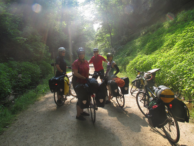
Before we knew it, we were on the trail.  For me, it felt great to just be outside, riding.  I work at a desk job all day, and it doesn’t always suit my personality and desired activity level.  Also, I noticed right away that the trail was in great condition.  The surface is sort of a packed, crushed stone and it had few bumps and holes (quite unlike the C&O Towpath experience!). Surprisingly, the trail wasn’t all that crowded, and I wondered if that was unusual for a holiday weekend.

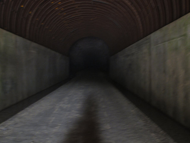
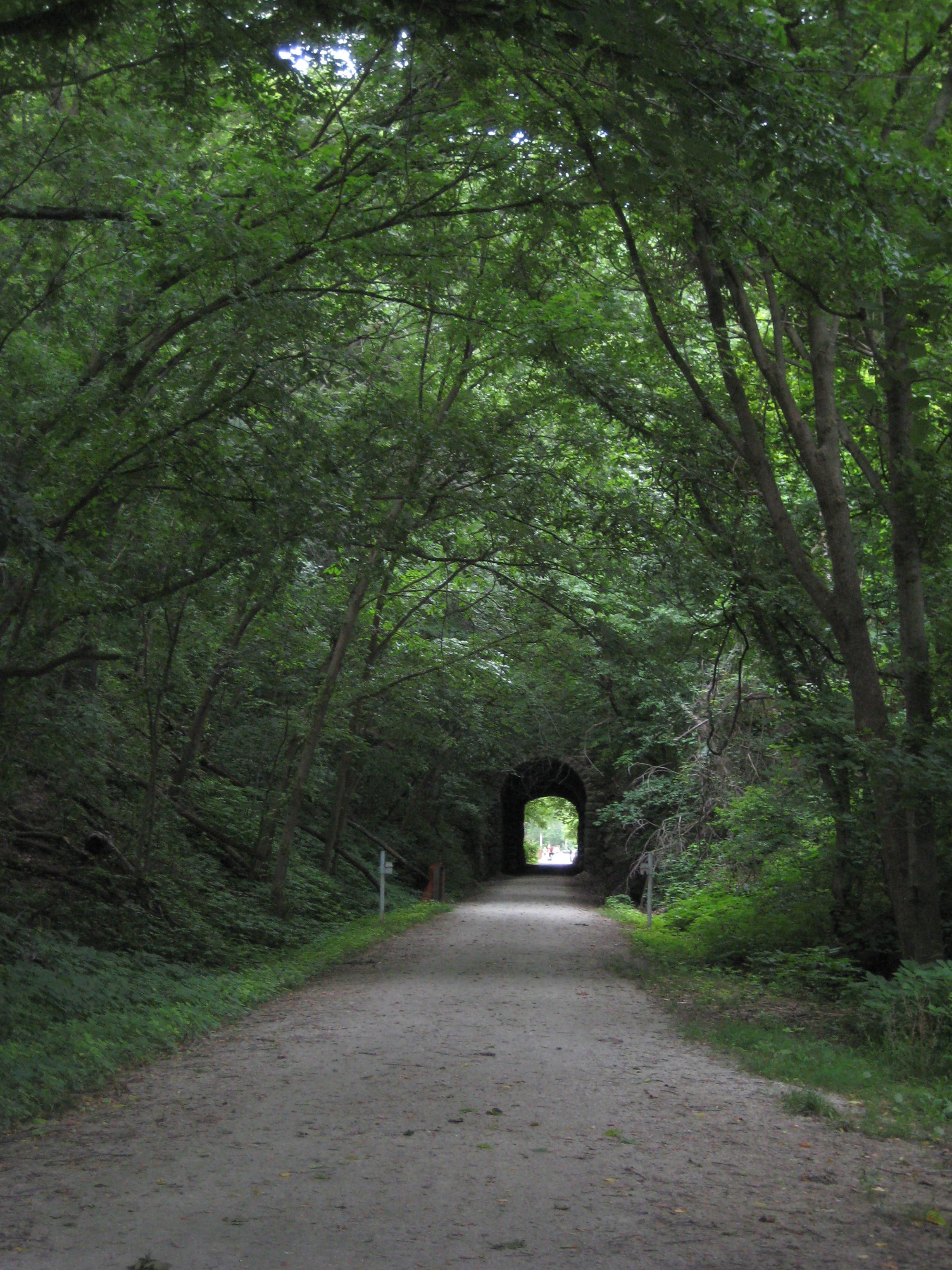
Soon enough, we came across the first tunnel of three:

Tunnel 1

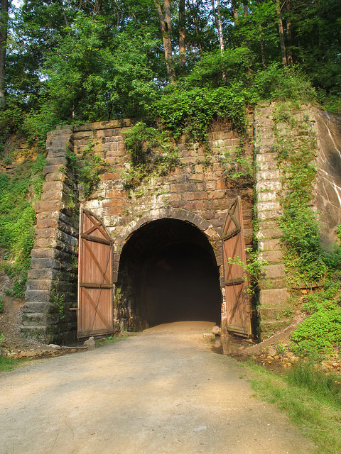
We found it quite cool and entertaining.  Obviously, upon entering a tunnel, it is necessary to make various hoot and hollering noises. Also, according to a sign, we were required to get off our bikes and walk them through the tunnel, due to the wet, bumpy surface and lack of light.  If one didn’t have a light, it would be difficult to pass. Look at how scary it would be:

Spooky Tunnel

Not to worry though, we made it through in no time:

Waves

We continued riding and stopped for a short break at a rest area off the trail.  There, we ran into more trouble:

Lions

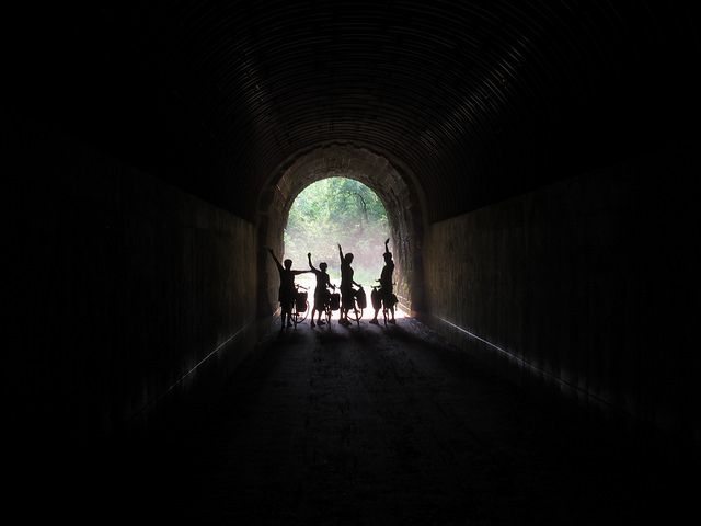
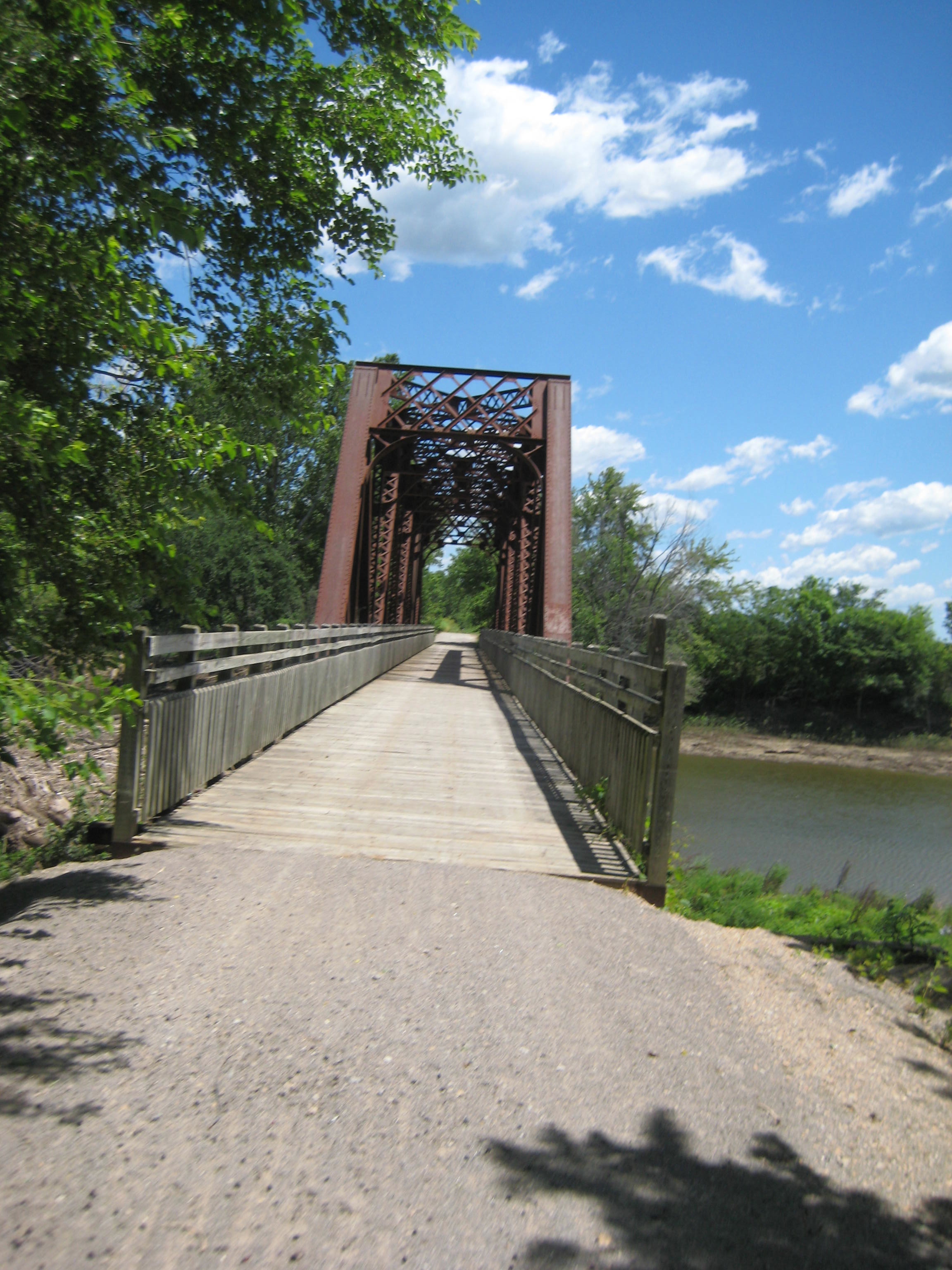
Bike trips can be quite dangerous.  We encountered two more tunnels along the way, including the final one, which was over 3000 feet long and in which we couldn’t see the end when we entered it.  Inside the tunnels, it was at least 20 degrees cooler than outside, and the walls and ceiling were dripping with water.

Fortunately, we made it to the Sparta DNR campground while the sun was still out.  I’d like to say that we then peacefully set up our tents and enjoyed a long, enjoyable night around the campfire. However, upon entering the DNR site, we were immediately swarmed by mosquitoes, despite practically emptying bottles of bug spray over ourselves.  So, we quickly ate dinner and retired to our tents, where it was (mostly) safe.  We all had many mosquito bites, including several of us with bites on our faces and eyelids (awkward).

The next morning, we ate a quick breakfast at camp and then decided to depart for the day, not to return until bedtime (due to the mosquitoes).  The plan for the day was to ride a bit on the La Cross River State Trail, which runs about 22 miles from Sparta to La Crosse, WI, and then return to Sparta in time for the town’s 4th of July celebration.

So, after leaving our campground in Sparta and getting back on the trail, we quickly encountered the Sparta Depot:

L and A

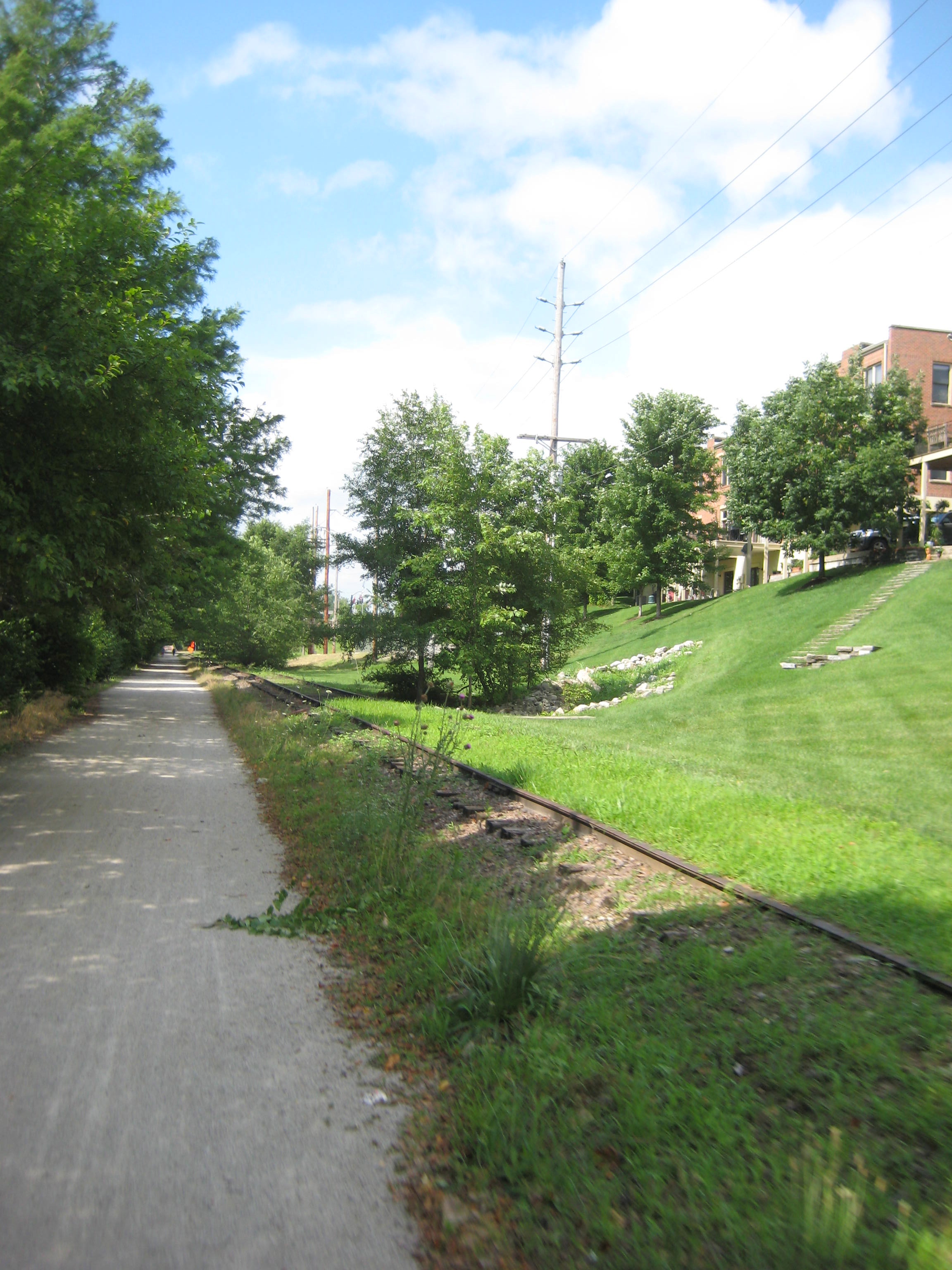
We rode for about 10 miles on the La Crosse River Trail, which was also a quite nice trail.  It traverses through farm land and small towns, and it seemed to not have as much tree cover as the Sparta Elroy Trail.  We also rode past these giant mounds of sand. It actually wasn’t clear what these big mounds were, or what exactly went on at this sand factory, but “sand factory” seemed like the best guess:

sand

At Bangor, WI, we arrived at a park just off the trail, where people were setting up 4th of July festivities. These festivities included grilling large amounts of meat on massive grills, fishing in a local stream, playing  bingo, and shooting guns at a shooting range at the park. The park also had a veterans’ memorial, complete with a helicopter and tank, which we had to check out:

Bangor Park

We stopped here for a couple of hours and ate lunch, rested, and played cards.  It was a bit hard to relax too much, due to the continual shooting (I think Ellen has a recording of what it sounded like there), but it was still a nice break.  After hanging out in Bangor, we decided to head back to Sparta for some important business meetings.

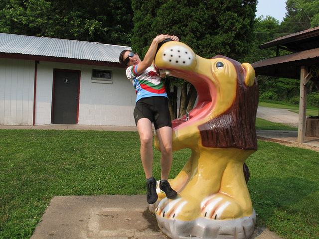
First up, we had to stop by Ben Bikin’s place and convince him to stay in Sparta:

BB

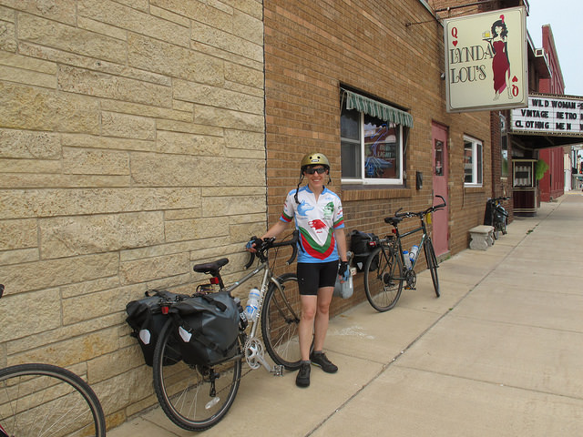
Then, we had to stop by the legendary Lynda Lou’s in Sparta, for some competitive shuffleboard, Spotted Cow beer drinking, and Jenga-playing:

LL

We also spent quite a bit of time at Memorial Park in Sparta, which was having a 4th of July celebration. Various tents were set up, including an especially popular one that sold apple pie, frozen custard, and root beer floats.  Nearby was a water park, where we were all grateful to be able to take showers (side note: it’s a good thing, too, because when Lauren washed her hair, a large beetle fell out).

The fireworks display started shortly before 10 pm, and we watched them for a bit, before riding our bikes back to the campsite:

fireworks


Upon reaching our campsites, we quickly hung our food and then hopped into our tents before the mosquitoes could get us too badly.  All of the other DNR spots seemed taken at this point, something I think we were all slightly worried about before the trip.  The DNR sites are first-come, first-served, and reservations are not accepted. So, planning a bike trip around staying at such sites can be somewhat risky, especially as based on my research prior to the trip, many commercial campsites had 3-night minimum stays over weekends and holidays. Luckily, it worked out for us, although I think we could have figured something out had the site been full.

The next morning, we broke camp in record time and, one by one, we gathered at the trail to begin the ride from Sparta back to Elroy.  I would have been happy to have a few more days riding, so it was hard not to be a little sad about it being the last day. However, we still had a full day ahead of us, so I tried not to dwell on that:

last day

We had a nice ride back to Sparta, making pretty good time.  The pattern of the trail is that it’s somewhat rolling (for a rail trail), with the 3 tunnels being at the peaks.  Periods of climbing are eventually followed by periods of downhills.

Overall it was a great trip:

TheEnd

Our total mileage was about 96!


KATY Trail

In July 2013, I was part of a small group that biked Katy Trail State Park (aka – the Katy Trail).

This trail runs 237 miles across the state of Missouri, along what was formerly the MKT trail line. Now, I didn’t have this website back in 2013, but I’m going to try to piece together the trip as best I remember from my notes and itinerary.

On this trip, I went with 3 other people. Like GAPCO, we did this trip entirely self-supported, carrying our own gear on panniers. Unlike GAPCO, where we camped and stayed in hotels half the nights, we stayed in hotels/B&Bs every night of this trip. That definitely made the trip more comfortable, as it’s nice to have a soft bed at the end of riding all day. However, after doing both, I prefer to add in camping, both because I really enjoy camping and because it makes the trip less expensive. What I’ve found is that bike adventure trips can be as inexpensive (or not) as you make them, and staying in hotels and eating at restaurants each night definitely adds up on a trip.

Logistically, the trip began with our group driving in a small SUV, with a bike rack carrying 4 bikes, to St. Louis, MO.  From St. Louis, we took an Amtrak to Sedalia, MO, near the Western terminus of the trail. Technically, the trail starts a bit further west in Clinton, MO, but the Amtrak doesn’t go to there.

KTStart

Day 1- Sedalia to Boonville (35 miles)

Once we arrived in Sedalia, we had a nice lunch at a diner, finalized preparations on our bikes, and then took off.  What I remember is that we kept our first day of biking pretty light, only going from Sedalia to Boonville – about 35 miles. Still, it was very hot and humid, and we were adjusting to carrying gear on our bikes!  We were all glad it was a “short” day.

At Boonville, we stayed at the Isle of Capri Casino, where we had made reservations prior to the trip.  I was quite glad of having a room and a bed. Plus, casinos tend to have great air conditioning. Playing roulette and having a few cocktails also helped us recover from the day of traveling and riding.

Boonville

Day 2- Boonville to Hartsburg (~40 miles)

From Boonville, our next destination was the Katyrest Caboose in Hartsburg.  I remember enjoying this section of the trail, as it followed pretty closely to the Missouri River and was rather shaded by tree canopies. This part of the country is really quite lovely:

KT3

Excitingly, we went a tad off the trail to stop by and see the World’s Largest Oak Tree. It seemed true to its name:

OakTree


And then, most excitingly of all, we arrived at the Katyrest Caboose, where we got to relax and cool down from the day’s ride:

Caboose


Day 3 – Hartsburg to Marthasville (76 miles) – 

Dun dun dun! Day 3 was our longest of the trip, clocking in at 76 miles. Which, on a light road bike and without panniers, is not all that difficult. But, with packs, on crushed limestone, and hybrid/mountain bikes, is a little more difficult.  Not that I’d trade it for a vacation of lounging on a beach and doing nothing, of course!

The Midwest has a reputation of being “flyover country,” but I continued to be impressed by the landscape on this ride.  We went over many bridges, through tunnels, along bluffs, and through stretches of forest that I’m sure many people never see.

KT4

Also, like GAPCO, the Katy Trail has cool, quirky features to show hospitality to those who ride.  Along the way to Marthasville, there was a non-staffed rest stop with a stocked refrigerator operating on the honor system. I’m not sure who fills the ‘fridge with Gatorade, sodas, and snacks, but we were grateful for it (and we dropped money into the canister):

KT5


On this day, I also remember getting a mystery rash on my legs during the last couple hours. Exciting!  It turns out I get heat rash on my lower legs, probably due to combination of dust, sun, and sweat.  I also experienced this on the Trans Catalina Trail. (Was that too much information?).

Day 4 – Marthasville to St. Charles (~38 miles)

On our next to last day of riding, we rode from Marthasburg to just outside of St. Louis, in St .Charles. As we got closer to the city, the trail got more and more crowded with other bikers and families. While before, in more rural locations, we were able to ride 2×2, we were most relegated to riding single file.

Just as we were arriving in St. Charles, where he had a hotel room reserved, it began to rain. Luckily, that was really the only time we got rained on during the trip. In St. Charles, the trail ran parallel to an abandoned (I think?) rail line.

KT5


Day 5 – St. Charles to St. Louis (~40 miles) –

The last day of a bike trip is always bittersweet for me. On the one hand, it’s always such an accomplishment to finish a trail, but that also means the vacation is over.  Nonetheless, we departed from St. Charles and headed for St. Louis, to the Amtrak station where the car had been parked.

Probably for all of us, this was the most harrowing riding of the trip. We had been accustomed to riding on trails segregated from cars, but once we got into St. Louis and headed toward the Amtrak station, the trail ended, putting us on roads without bike trails. If I were to do this ride again, I would pay more attention to the ride from St. Charles to St. Louis and try to find a less congested route.

In all, it was a great trip, and I really would consider riding the Katy Trail again, perhaps adding some camping nights into the experience!

Trans Catalina Trail, Part 2

Have you read Wild, by Cheryl Strayed – or seen the movie?

Well, when I read the book, I remember feeling pretty judgmental of her twice. One, for taking off on a backpacking trip that she seemed so unprepared for: “What is hiking, but walking after all? I can walk!”  And two, for packing a ridiculously-heavy pack.

Well…. so, living in the Midwest, one detail we might have overlooked on the TCT was elevation change.  The TCT is, to put it bluntly, brutal in terms of elevation changes. For most of it, you are either hiking up or hiking down – steeply. And despite its steepness in many places it does not include many switchbacks that would help make the hike less strenuous. For comparison, I have hiked up and down the Grand Canyon, and even that did not seem as steep as some of the inclines on the TCT.

After leaving the restaurant in Avalon, I remember settling my pack onto my back, with a little help from my friends, and thinking, “… really?” Then, like Strayed (who was hiking the Pacific Crest Trail), I remember being about 30 minutes into the hike and thinking, “What have I gotten myself into?”, among less polite… things.

My backpack, estimated at about 35 pounds, was digging into my shoulders. When I adjusted the straps on my shoulders to put more weight on hips, my hips fatigued very quickly. My water bottles were annoyingly clanking around behind me. I questioned my shoe choice (trail running shoes rather than hiking boots). I could not get comfortable and just ease into the simple act of walking, uphill.  I had, stupidly, over-packed.

And then, we eventually arrived at the trailhead, Mile 0 of the TCT:

Mile 0

Welp, time to get started!

At this point, we decided it would be a good time to stop and stretch for a bit. It was also here that I realized that the group was about on the same page in terms of the hike being difficult, and that it wasn’t just me who was feeling challenged. The uphill hike had begun almost immediately after leaving the restaurant, before we even reached the trail. So, that was something – I at least wouldn’t have to worry about others wanting to go super fast and me slowing everyone down.

It was also a good break for me, mentally, to remember that the first couple days of every backpacking trip I’ve been on have been very difficult. There’s a “breaking in” period where different muscles are used, become sore, and then get a little more used to the act of backpacking.

16370041733_f8c14522db_z

Here we go

And so, onward we went. The first day, from Avalon to Hermit Gulch Campground, I remember feeling as though the vistas were incredible – we were surrounded by the Pacific Ocean, and kept seeking Avalon at different angles, from above, getting smaller and smaller.  We took the first day pretty slow, averaging maybe 2 miles per hour, climbed to a high of about 1,800 feet and descended again just about all the way to sea level to our campground. That first night, I crashed hard, falling asleep at 8 pm, before everyone else, and practically didn’t open my eyes again until 7 am.

Day 2 began with, what else, a very tough 1.2 mile climb out of Hermit Gulch campground of about 1,500 feet. At the top, was this convenient little pavilion thingy, where we of course took a break:

Pavilion

Relief!

This day was also quite difficult, but again, we were surrounded with stunning views in terrain very different from the Midwest:

16989540321_6973d3a575_z (1)

Blackjack Campground was primitive, but still very clean, like all of the campsites we saw on Catalina. Lauren and I took ice cold open air showers, and the 12 or so other people at the campground mostly did their own thing. The next day, Day 3, was the day I felt the best hiking. My soreness from the previous 2 days was largely gone, the weather was cool, and we got to see Airport in the Sky:

16989008352_35dddca182_z

The Airport had an old-timey diner in it, so we got to eat some good cooked food for lunch, and also use real restrooms – true luxuries while backpacking! The last half of the day was mostly downhill, which is painful in a whole different way compared to uphill, and we arrived at my favorite campsite of the trip, at Little Harbor. There, we had a prime campsite right on the beach.

Little Harbor

Little Harbor

After swimming (with a harbor seal spotted!), frisbee playing, and karate practice in the sand, we had dinner and played cards.  Foxes were quite common near campgrounds on the island, especially as the sun set. They were friendly to people, looked pretty cute, and mostly were very interested in trying to get our food. To keep our food safe, we kept some of it stored in a bear can overnight and hung the rest of it in the palm trees in bags, both of which worked well.

The next day, Day 4, was going to be our longest, most difficult day, from Little Harbor to Parson’s Landing. We began the day with a very difficult 2 miles hike up about 1,500 feet and then down the same distance and elevation into Two Harbors. The temperature this day was in the mid-80s, making the hike particularly grueling. The footing at times was also loose rock and felt precarious, but the scenery was also beautiful:

16988814032_934841dbcd_z

After a lunch break in Two Harbors, we opted to take the West End Road to Parson’s Landing, which was a longer yet flatter path to Parson’s Landing.

West End Road

However, we eventually decided to go back to Two Harbors. A couple of us weren’t feeling well, I had a mystery rash spreading up my legs, we had seen much of the island already, and we felt that we had accomplished a lot. What I have learned on various adventure trips is the importance of adjusting itineraries in response to the physical environment and changing circumstances. We learned this repeatedly on the Great Allegheny Passage/C&O Towpath (GAPCO) bike trip!

Hiking the Trans Catalina Trail was, for me, amazing and also very difficult.

...Really?

It was nice to give in, spend an extra day in Two Harbors, and have a more relaxing vacation before having to return to our daily lives and work back in the Midwest.

One of the Two Harbors

One of the Two Harbors

For anyone planning to hike this trail, I’d recommend lots of incline training. I also think we went at a good time of year (late March), but got a little unlucky with the heat on 1 day. The trail didn’t seem super crowded, and we encountered enough other people so that it didn’t feel completely isolated. The people we did encounter were generally friendly. All in all, it was a great trip.

(See also, Trans Catalina Trail Part 1)

Trans Catalina Trail, Part I

I recently completed a trip that, while not a bike trip, might still be of interest to those who enjoy outdoors, biking, and camping.

2 weeks ago, with 3 other people, I hiked the Trans Catalina Trail (TCT), off the coast of southern California.  In addition to myself, the cast of characters for this trip includes Lauren, Yesica, and Autumn. The TCT runs about the length of Catalina Island, 37 miles. According to the Catalina Conservancy, cycling is allowed on about 8 miles of the trail. Backpackers can hike the entire trail, and can access designated campsites along the way, which is why we chose to backpack.

To begin the journey, we took a ferry (the Catalina Express) from Long Beach Harbor to Avalon on Catalina Island. I was a bit nervous about the ferry ride, as I’ve had bad experiences with them in the past in terms of motion sickness. However, the weather was perfect and it wasn’t too wavy, so I was fine.  I also popped a Dramamine beforehand, just in case.

I think we were all pleased to see various group of dolphins swimming  next to the ferry at various points along the way. We all live in the Midwest, so we’re easily fascinated by such things. Anyway, upon arriving in Avalon, we ate breakfast at a diner, and made final preparations to our packs before setting off.  Here’s Avalon, from within a residential area (all photos by Yesica, who is a much better photographer than me):

Avalon

Avalon, from above:

Our itinerary for the trip was:

  • Day 1: Avalon to Hermit Gulch Campground (~6.5 miles, 1328 ft. elevation change)
  • Day 2: Hermit Gulch Campground to Blackjack Campground (~8 miles, >2000 ft. elevation change)
  • Day 3: Blackjack Campground to Little Harbor Campground (~7 miles, ~1750 ft. elevation change)
  • Day 4: Little Harbor Campground to Parson’s Landing (~11 miles, ~2928 ft elevation change)
  • Day 5: Parson’s Landing to Starlight Beach, and back to Parson’s Landing (~9 miles)

Here we are right before leaving Avalon, fresh and innocent:

LeavingAvalon

And, we’re off:

Avalon3


Continue reading about the TCT adventure. here.

« Older posts Newer posts »